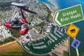
Aerial Photography is one of the most popular part of Remote Sensing. A machine, especially an aircraft or a drone, i.e., Unmanned Aerial Vehicle (UAV) has the cameras attached. Therefore, it can capture photos from the higher surface. Photography from the air. Aerial photography is the taking of photographs of the ground from an elevated position. Aerial photography has been defined as the science of taking photograph from a point in the air for the purpose of making some type of study on earth surface. It was the first method of remote sensing and even used today in the era of satellite and electronic scanners. It is one of the most common, versatile and economical forms of remote sensing. Aerial photographs will still remain the most widely used type of remote sensing data.