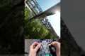
I developed a coaxial thrust vectoring drone equipped with an FPV camera and Qt-based groundstation software utilizing the Google Maps JavaScript API for online satellite image streaming.
Key features include:
• Custom flight computer firmware based on ESP32 RTOS • 9 DOF IMU • Barometric pressure sensor • GPS-based waypoint navigation with standby functionality • High-frequency DShot protocol for ESC control • iBUS RC bus integration • Pitch-stabilized FPV camera • Controllable FPV camera angles via FPV goggles • Drone failsafe mechanisms for lost RC signal and roll/pitch angle limits • Intuitive Qt-based groundstation software: • Online streaming of satellite imagery via Google Maps JavaScript API • Route definition using waypoints with custom altitude and hold timeout settings • Drone diagnostics visualization • Flight time counter with customizable alarm threshold
00:00 Automated Thrust Testrig 00:43 Stabilized FPV Camera 01:41 Drone Frame 02:27 Drone Assembly 03:11 Firmware Flight Computer 03:55 Data Link 04:24 Groundstation Software 05:11 Drone Flight